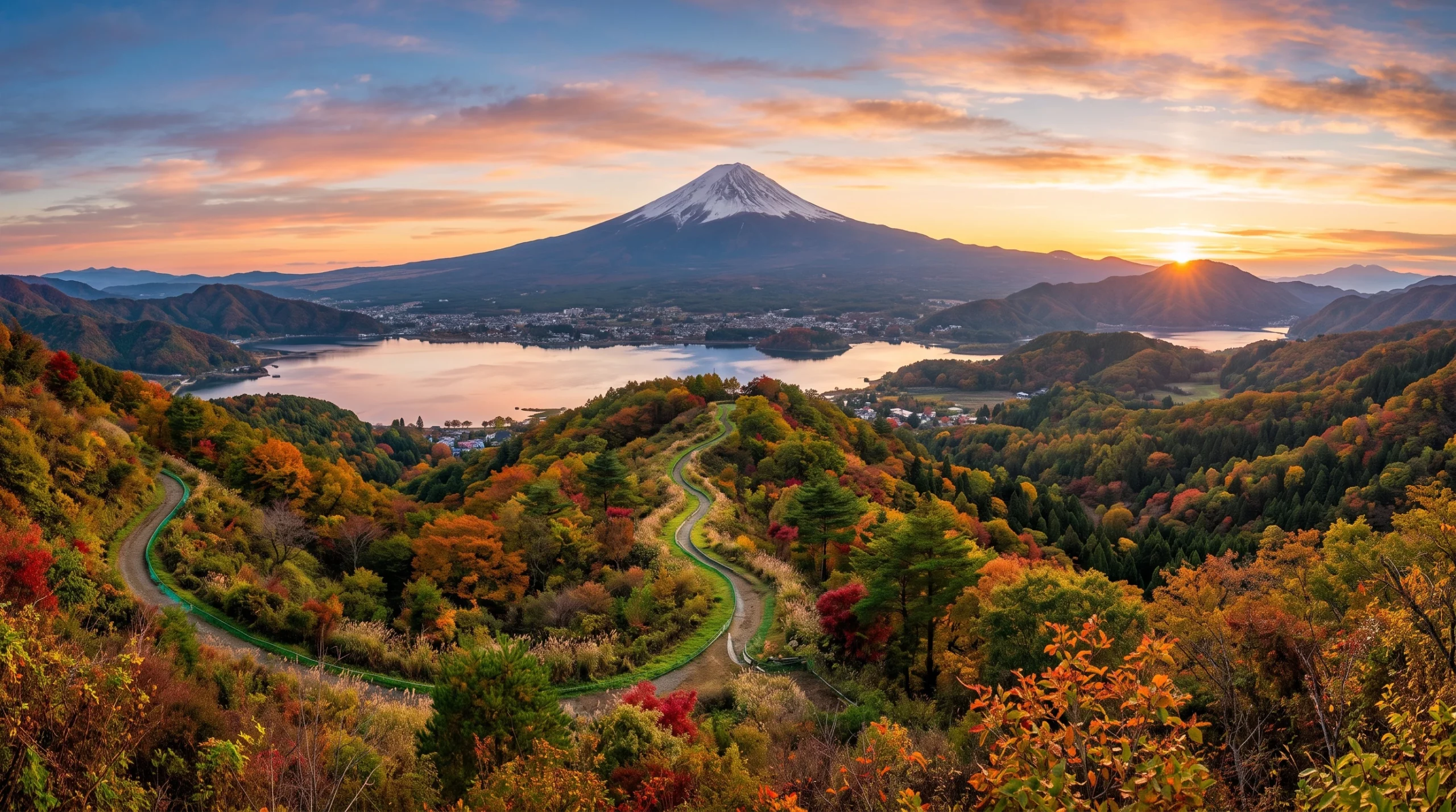
The best hiking trails near Mount Fuji (富士山) for panoramic views include Chureito Pagoda, the Kawaguchiko lakeshore, Mitsutogeyama, Ryugatake and the Hoei Crater trail, each offering a distinct angle on Japan’s most iconic peak. This guide covers the top routes, transport logistics and seasonal planning tips so you can capture unforgettable Fuji views without missing the essentials.
Why Hike Around Mount Fuji for Panoramic Views?
Hiking near Mount Fuji offers more than physical exercise; it is a direct route to some of Japan’s most memorable landscapes. The Fuji Five Lakes region (富士五湖), lesser known ridge trails, and nearby national parks all offer unique perspectives on the mountain’s near perfect cone. Good trail infrastructure, reliable transport and clear seasonal viewing patterns make hiking here a practical choice for UK travellers.
The trails here also showcase lakes, volcanic ridges and remote shrines, adding cultural depth to the scenery. Each season brings a different palette, from cherry blossom pinks in spring to crisp, snow capped views in winter. Weather, crowds and trail conditions vary considerably, so a little planning goes a long way toward getting the best views for your effort.
Mount Fuji holds deep spiritual significance in Japan and remains a symbol of endurance and beauty for both locals and visitors. Many trails connect to a long tradition of mountain worship known as Fujiko, and interpretation boards found along popular routes explain this history in more depth than simple sightseeing allows.
Top Hiking Trails Near Mount Fuji
These five routes reliably deliver strong Fuji views alongside a practical hiking experience, ranging from easy strolls to genuine half day treks.
Chureito Pagoda Trail (忠霊塔)
- Location: Arakurayama Sengen Park, Fujiyoshida (富士吉田市)
- Distance: Roughly 1.4km return, via 398 stone steps from the shrine to the pagoda
- View: The classic postcard shot of Mount Fuji rising behind the red five storey pagoda, especially striking with cherry blossoms in spring
- Why visit: Quick, accessible, and delivers one of the single most photographed views of Fuji in Japan
Access: Take the Fujikyu Railway to Shimo Yoshida Station, then walk about 10 minutes to the base of the steps. Entry to the park and pagoda grounds is free.
Lake Kawaguchi North Shore (河口湖)
- Location: Kawaguchiko (河口湖町)
- Route: Gentle walking paths and cycling tracks along the northern and eastern lakeshore
- View: Wide, open Fuji views reflected in the lake, accessible year round
- Why visit: Easy for families and ideal for sunrise or sunset photography
Mitsutogeyama Trail (三ツ峠山)
- Location: Trailhead near Mitsutoge Station (三ツ峠駅)
- Distance: Roughly 10 to 12km round trip, taking 4 to 5 hours
- View: Elevated lookouts with sweeping panoramas of Fuji, the Five Lakes, and the Southern Alps on a clear day
- Why visit: A genuine alpine feel with fewer tourists than the lakeside trails
Mount Ryugatake Trek (竜ヶ岳)
- Location: Trailhead near Lake Motosu (本栖湖)
- Distance: Roughly 10km round trip, a moderate climb
- View: Panoramic views of Fuji and the surrounding lakes from the summit
- Why visit: A good balance of challenge and reward, with spring azaleas and winter frost both photogenic
Note that the specific 1,000 yen note viewpoint of Mount Fuji is located at the Nakanokura Pass observation area on the northwest shore of Lake Motosu, a separate spot from the Ryugatake summit trail itself, though both are easily combined into the same day trip around the lake.
Hoei Crater Trail (宝永火口)
- Location: Fujinomiya Fifth Station (富士宮口五合目)
- Distance: Around 5km round trip, a moderate half day hike
- View: A lunar like landscape around the crater rim, looking directly back at Fuji’s main summit
- Why visit: The volcanic terrain feels genuinely otherworldly, and it works well as an alternative when the main summit trail is closed or unsuitable
For more variety with smaller crowds, quieter trails near Lake Saiko or the foothills around Oshino Village offer peaceful walking, and some routes finish near hot spring facilities where you can relax after a day outdoors.
Klook.comPlanning Logistics for Mount Fuji Hiking Trails
Best Access Points and Transit Tips
- Train: The Fuji Excursion limited express runs directly from Shinjuku to Kawaguchiko in around two hours, with no transfers needed. A one way ticket costs approximately 4,200 yen. JR passes cover the route as far as Otsuki, with the remaining fare payable separately.
- Bus: Direct highway buses run from Tokyo, Shibuya and the Tokyo airports to Kawaguchiko and the Fifth Station, with one way fares typically around 2,000 to 2,200 yen depending on where you book.
- Car hire: A rental car from a company such as Times Car Rental or Toyota Rent a Car makes early dawn hikes or remote trailheads easier to reach, especially for families or groups.
- Booking tip: Reserve transport in advance through Klook or Trip.com for e tickets and English language support.
Official information: Fuji Excursion, Fujikyu Railway
Trail Infrastructure and Facilities
Trails around Mount Fuji range from fully managed paths with signposts, restrooms and mountain huts (山小屋) to quieter local tracks with only basic waypoints. The Five Lakes area is highly developed, while alpine routes such as Mitsutogeyama feel considerably more rural. Most major trailheads have luggage storage, vending machines and lockers, which is useful if you are arriving straight from Tokyo by train or bus.
Several walking paths are wheelchair accessible or stroller friendly, particularly around the Lake Kawaguchi area, where wide path sections make classic views accessible to everyone. Tourist information centres provide English language maps, and many host small gear shops for last minute rental or supplies.
Peak Seasons
- Cherry blossom season (late March to mid April): Chureito Pagoda and lakeshore walks are busiest; arrive early to get your shot without large crowds.
- Golden Week and summer holidays (late April to August): Local roads and buses can see queues, so booking ahead for seats and accommodation reduces stress.
- Autumn (late October to November): Colourful foliage, quieter trails and crisp air make this a strong season for photography.
- Winter (December to March): Clear air often delivers the sharpest views of the summit. Pack extra warm clothing and check trail conditions carefully after snowfall.
If staying overnight for a multi day trip, book mountain huts near Mitsutoge or the Fifth Station well in advance, since space fills quickly during summer climbing season. Outside peak season, smaller guesthouses and farm stays offer a quieter alternative.
Quick Comparison: Mount Fuji Panoramic Trails
| Trail | View | Distance | Elevation Change | Difficulty |
|---|---|---|---|---|
| Chureito Pagoda | Iconic pagoda and Fuji in one frame | 1.4km return, 398 steps | 120m gain | Easy |
| Kawaguchiko Lakeshore | Water reflections, wide panorama | Up to 10km | Minimal | Easy |
| Mitsutogeyama | High ridge, wide alpine view | 10 to 12km | 900m gain | Moderate |
| Ryugatake | Summit panorama near Lake Motosu | 10km round trip | 700m gain | Moderate |
| Hoei Crater | Crater rim, Fuji backdrop | 5km return | 400m gain | Moderate |
Important Trail Tips for Western Travellers
- Check the official Japan Travel site for detailed route status, accommodation links, and bilingual trail maps.
- Carry cash in yen, since small shops and on trail vending machines do not always accept foreign cards.
- Pick up a prepaid Japan eSIM through Airalo or at the airport for navigation and translation support.
- Respect local trail etiquette: keep noise levels down, avoid littering, and do not enter shrines or private land without permission.
- Most public transport stops running by around 7 to 8pm, so if you are hiking for sunset, arrange accommodation or a taxi back in advance.
- During busy seasons, book activities through platforms like Klook or Trip.com to avoid long queues for popular attractions.
Seasonal Events Near the Trails
Fuji Shibazakura Festival (富士芝桜まつり)
Held from mid April to late May near Lake Motosu, this festival covers fields with pink moss phlox, adding vivid colour to Fuji views. Tickets can sell out during peak bloom, so booking through an official travel platform in advance is worthwhile.
Kawaguchiko Autumn Leaves Festival (河口湖紅葉まつり)
Running from late October, this lakeside festival lines the walkways with fiery maple trees (紅葉), framing Mount Fuji in rich autumn colour. Pop up food stalls and evening illuminations make it appealing even for casual walkers, not just photographers.
Summer fireworks festivals also take place around the lakes on various dates, sometimes lighting up the sky against Fuji’s silhouette, a genuinely memorable sight if your timing lines up.
Recommended Accommodation for Hikers
Staying close to your trailhead saves valuable time in the early morning, making it easier to catch sunrise views or avoid crowds.
- Kawaguchiko Station area (河口湖駅周辺): A mix of budget hotels and mid range resorts with onsen baths, several with English speaking staff, easy luggage transfer, and good food options including izakaya and ramen shops.
- Lake Motosu (本栖湖): Campsites, glamping and small ryokan, some with Fuji facing rooms for sunrise. Kayak and bicycle rental is often available for time outside hiking.
- Mitsutogeyama base: Country guesthouses, farm stays and business hotels a short ride from the station, some offering local food experiences or simple guided walks if booked ahead.
Weather Considerations and Trail Safety
- Summer: Humidity and afternoon thunderstorms are common, so an early start gives clearer skies and safer conditions.
- Winter: Icy trails make trekking poles and microspikes a sensible investment. Pack layered clothing and check with your accommodation about any last minute trail closures.
- General: English trail signage is improving but can be patchy in remote areas, so download offline maps before you go. Bring a portable battery pack, since cold weather drains devices faster and signal can drop in forested valleys.
- Always tell someone your planned route and expected return time. Local rangers and police appreciate a heads up for longer or less travelled trails, particularly outside the busy summer season.
Frequently Asked Questions
What is the best month for panoramic Mount Fuji views?
December to February usually offers the clearest visibility. Autumn is also excellent, with colourful foliage and fewer crowds, while early spring brings cherry blossoms but larger crowds on popular trails.
Can children or older adults manage these trails?
Chureito Pagoda and the Kawaguchiko lakeside walk are very family friendly. Mitsutogeyama and Ryugatake suit those with hiking experience due to the elevation gain, though healthy older adults regularly complete them with sufficient rest.
How do I buy Mount Fuji area rail and bus passes?
The Fuji Hakone Pass, JR Tokyo Wide Pass, and local bus tickets can be purchased online through Klook or Trip.com, or in person at major Tokyo stations. Booking in advance is recommended for busy weekends and festival dates.
Are English trail maps and signage available?
Lakeside areas and major trailheads usually have good English support, while remote trails are more basic, making offline map apps a sensible backup. Map boards near trailheads and visitor centres typically include written and pictorial guides suitable for first time hikers.
Is wild camping allowed near Mount Fuji?
Wild camping is generally not permitted. Designated campsites around the lakes operate year round but should be reserved in advance, especially during peak periods.
Bookmark this guide for your trip planning, and check official Japan travel portals for route updates, seasonal passes and festival tickets closer to your travel dates. Even with just a day or two in the Mount Fuji region, following these tips should help you capture the iconic shot and leave with lasting memories.